June 25, 2013
Distance: 37.2 miles Climbing: 2424.5 ft
We walked around Bulqize in the morning looking for breakfast and Ellet, but found neither. We still haven’t figured out breakfast here. There are tons of cafés, but they only serve drinks, and we never see anyone eating anything in the morning. In the larger towns we can usually find a bakery selling pastries, but there wasn’t an obvious one here. Chandler settled for a chicken gyro since he was starving. I was able to find some bananas, which at least gave me some fuel.
We got back on the highway and rode up a steep but short pass on the west side of town. On the other side we found a very long winding descent. We had a perfect view of the valley below, full of fields with limestone mountains in the distance. We made our way down into the valley to the town of Klos. We saw on our map that there was a rail line starting near there, so we thought about catching the train to change things up a little bit. The streets in the town were under construction and in a chaotic torn up state. It was quickly apparent that we were not going to be taking the train when we saw that the railroad ballast was excavated in some areas, maybe borrowed to help rebuild the roads? The rail bridges were all still intact but the rails themselves were gone. We rolled along through a valley full of family farms, with lots of people waving to us as we passed.

Good spot to pose for a photo
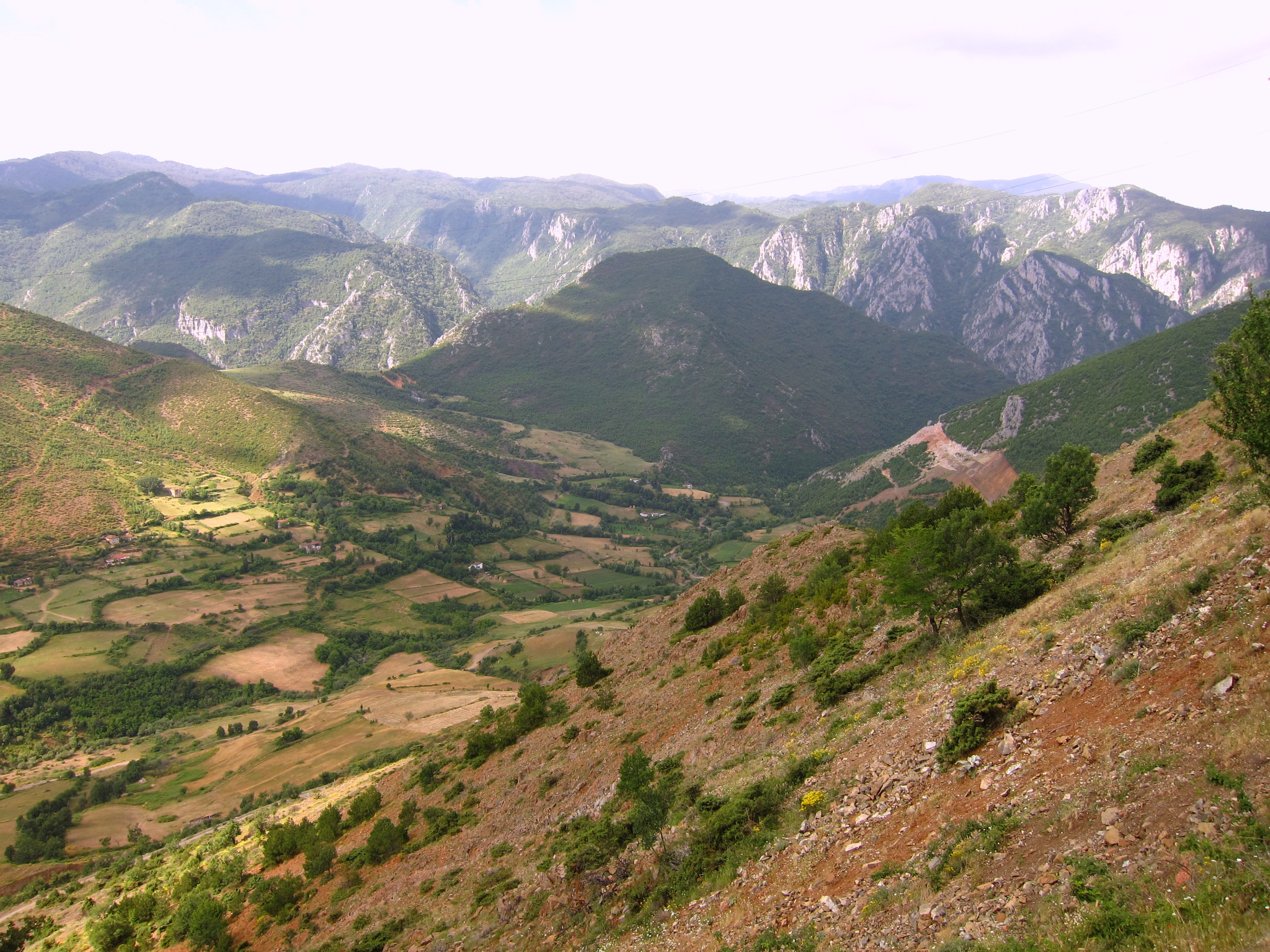
Down into the valley we go
We stopped at a gas station for some espresso and one of the guys sitting in the café spoke some English so we found out that the vote counting was still going on and there wasn’t a winner in the national election yet. Back on the bikes, we rode along through the valley until we made it to the outskirts of Burrel, which we quickly found out was up on top of a big hill. Our map showed two roads going in our direction, one up through Burrel, the other almost straight north. The north route looked shorter and we almost took it when we saw that the map had the road going straight through a large reservoir. We double checked on the GPS and saw the road dead ended at the reservoir, and now another road made a circuitous route around the east side, and up some big hills. So we climbed to Burrel. It wasn’t anything amazing, and we didn’t see a place to stop for pizza, plus it was just packed with people milling around in front of local national party headquarters. The whole place felt a little tense so we kept moving, back down the big hill on the other side of town.

Not the flag we were expecting to see

Looks a little too big to jump off
We rode along a ridge overlooking the south side of the reservoir and then made a big climb before descending into a river valley below the dam, which was out of sight from the road. After crossing a huge stone bridge we started chugging up the road perched up on side of the river valley. We saw a little café and stopped for a cold drink and a snack. There was a nice older lady running the place and she made sure we sat on the side of the deck with a gorgeous view overlooking the river. It was a really nice spot with a vineyard planted on the steep bank between the café/house and the river. After relaxing for a while we realized we were pretty beat and asked if we could camp for the night down below. The old lady seemed like she expected this and motioned that we should go down and stay in one of the small wooden sun shelters by the river. She handed us a big bottle of frozen water and we brought a couple of beers down with us too.

Chandler relaxing

Free campsite
We cooked dinner and then the women’s two sons came down to do some fishing. They went out on the river in a rowboat and set a long line of baited hooks for quite a way downstream. They came back to shore to wait and they showed Chandler all the fruits that they grew, and they talked about fishing by waving their hands around. As it got dark we said goodnight and went to sleep.

You guys look very happy and healthy! The scenery is fantastic. I guess that is what Vermont would look like if they cut all the trees. Nice shot of the flags. I guess there are places where folks still like the USA. Have fun and enjoy the different beers! Dad aka Steve